Tag: volcanoes
Go with the flow
The Big Island is so called because it is the biggest of the archipelago — hundreds in all, eight “main” islands. At 4,030 square miles, about three-quarters the size of Connecticut, it is larger than the other Hawaiian islands combined, and constantly increasing in land mass due to Kīlauea, perhaps the world’s most active volcano, which has continued to pour lava into the ocean since 1983.
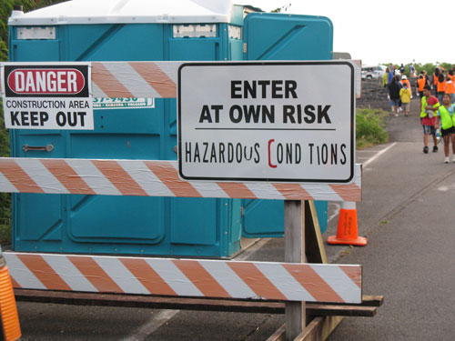
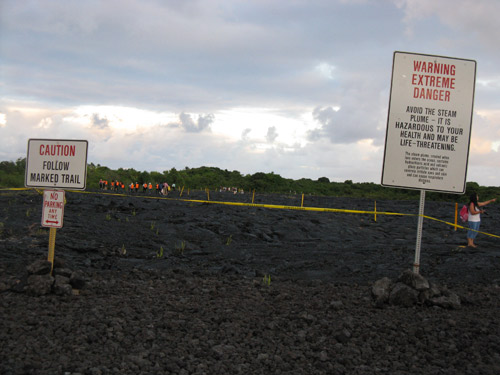
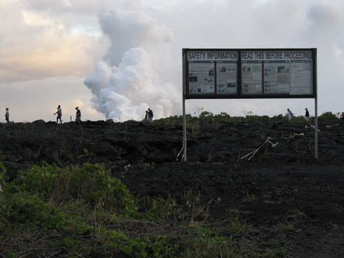
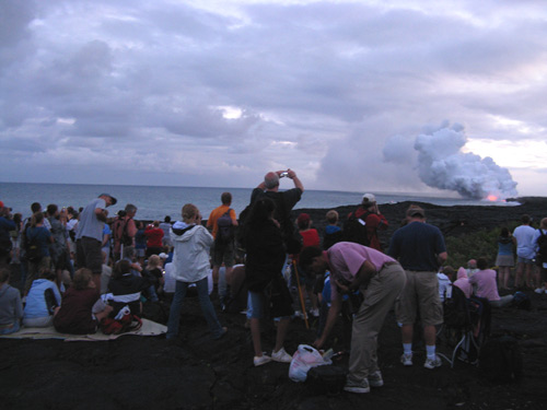
The spectacle of red molten lava hitting the water in blooming clouds of steam draws crowds every night. As the park rangers (and many signs) are quick to warn, trekking out to the view point is something done at your own risk.
Setting foot on this newly formed, perhaps not entirely stable, land is a disconcerting experience: 23 acres of land fell into the ocean last May; over several hours in November 2005, 44 acres of coastline disappeared in segments — the largest collapse since Kīlauea Volcano began its current eruption, and a collapse which included a park station and a segment of the original road out to the lava flow lookout point.
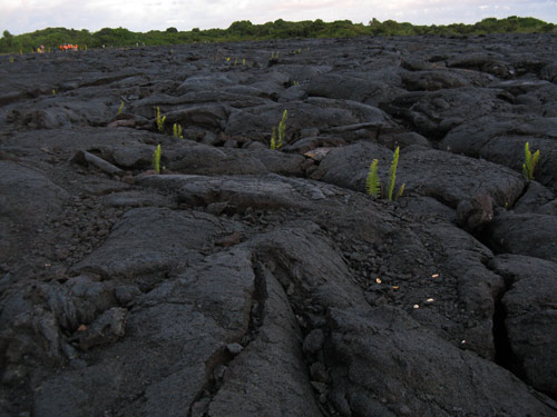
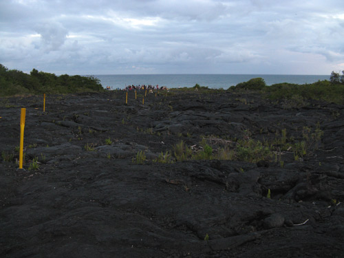
We drove out over a road washed over in parts in hardened lava and hiked half a mile over jagged black rock as we waited for sunset.
Check out the video below — spectacular!
Hawai’i Volcanoes National Park
Hawai’i Volcanoes National Park is a site on UNESCO’s World Heritage List and the most popular attraction on the Big Island, offering a glimpse of landscapes unseen anywhere else. From desolate stretches of volcanic rock and ash to lush green rainforests, from oozing lava to belching clouds of sulfur and hissing steam, it’s a tangible reminder of how actively the Earth continues to evolve.
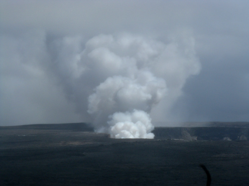
Since a small eruption in March, the Halema`uma`u Crater has been spewing clouds of sulfur dioxide gas into the air resulting in the partial closure of Crater Rim Drive:
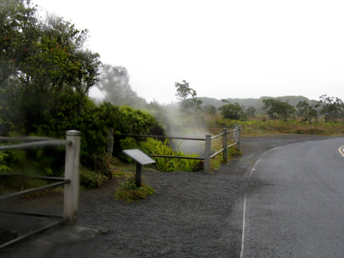
Steam forced to the surface when rainwater seeps into the ground, meeting with hot rock below:
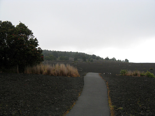
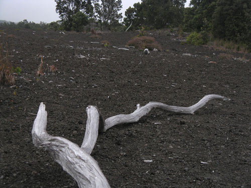
In 1959, an eruption in Kīlauea Iki Crater shot fountains of lava over 1100 feet high, blanketing this area along what is now known as the Devastation Trail. The patches of vegetation are the result of land left to regenerate on its own, as a kind of experiment.
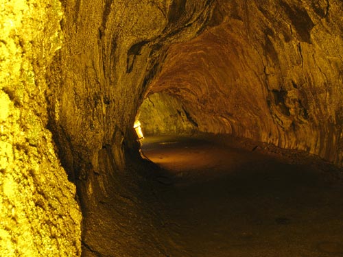
Thurston Lava Tube — an approximately 500 year old cave-like channel formed when slow-moving lava developed a hardened upper crust, forming a roof above the still-flowing lava stream. This segment of the tube is lit (another 1000 feet — open to the public, but blocked off by a chain link gate — is not), with ferns the only vegetation, sprouting up around the edges of the lights.
Check out the rest of the Hawai’i Volcanoes National Park photos on flickr.
| S | M | T | W | T | F | S |
|---|---|---|---|---|---|---|
| 1 | 2 | |||||
| 3 | 4 | 5 | 6 | 7 | 8 | 9 |
| 10 | 11 | 12 | 13 | 14 | 15 | 16 |
| 17 | 18 | 19 | 20 | 21 | 22 | 23 |
| 24 | 25 | 26 | 27 | 28 | 29 | 30 |
Search
Popular Tags
Categories
Archive
- July 2010
- July 2009
- January 2009
- November 2008
- September 2008
- August 2008
- July 2008
- June 2008
- May 2008
- April 2008
- March 2008
- February 2008
- January 2008
- December 2007
- November 2007
- October 2007
- September 2007
- August 2007
- July 2007
- June 2007
- May 2007
- April 2007
- March 2007
- February 2007
- January 2007
- December 2006
- November 2006
- October 2006
- September 2006
- August 2006
- July 2006
- June 2006
