Day: August 29th, 2006
Good bye, Pluto. Hello, Kryptonite.
Back at the apartment, I had a run-in with the super, and as a result, the work I had arranged to have done in the apartment this afternoon got postponed to tomorrow morning. So I guess I won’t be going back to the office until Thursday. Gotta love co-op living.
B, RS and JS were planning a trip into Manhattan, and joining them on their continuing tour of New York seemed vastly preferable to sitting at home sulking over my own thwarted plans. We met at the movie theatre and headed uptown to The American Museum of Natural History. (We were about to to hit the MoMA, until SYB reminded us that the museum is closed on Tuesdays. Good looking out!)
We entered the Rose Center for Earth and Space first, recalling to mind that the last time I set foot inside, a year and a half ago, it was 4:00AM on a pitch black and icy, mid-January morning. SYB, B and I (and a couple hundred other hardy/crazy souls) had made the trek there to witness the live feed of the Huygens spacecraft touching down on Titan, the largest of Saturn’s moons. When those first black, white and flaming orange grainy images started flitting across the screens before our bleary eyes, it was a sight to behold. The excitement at the Center was palpable, and well worth losing the few hours sleep.
Today, at a far more reasonable hour, we zipped among the fleets of Maclarens through the spiral walkway with the timeline of the universe (Big Bang to present): 13 billion years of cosmic evolution in ten minutes! I always liked the Scales of the Universe upper walkway feature, offering size comparisons ranging from the known universe to subatomic particles by using the 87-foot Hayden Sphere in the center as a reference.
As for the scaled model of the solar system inside: there is no Pluto. Never was, from the time the Center opened in 2000. A display for the model notes that “Beyond the outer planets is the Kuiper Belt of comets, a disk of small, icy worlds including Pluto.” A controversal concept at the time, now widely accepted.
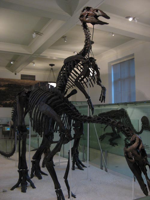
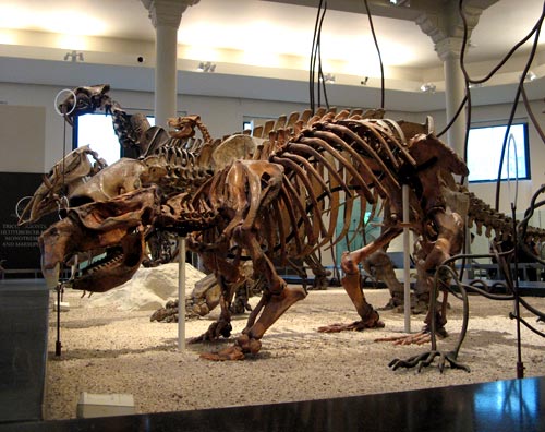
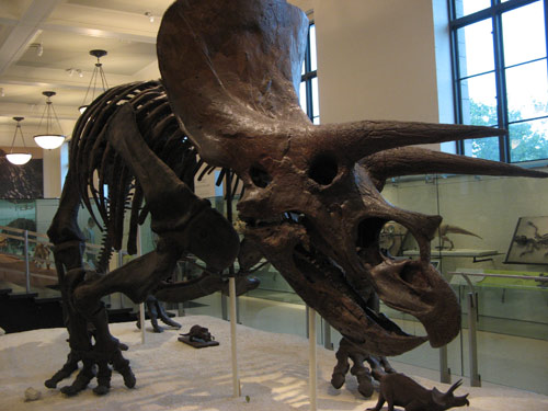
No field trip to the Museum is complete without checking out the dinosaurs:
And while we were there…
We were out of there in record time, opting for a leisurely dinner of New York pizzas with the visitors before the IMAX screening of Superman Returns… in 3-D! We were handed giant plastic glasses at the door to don for four film sequences (and the trailers, which were also projected in 3-D.) Actually, though, it was three film sequences and an approximately ten second long clip of the Man of Steel flying around just before the closing credits rolled. Still, pretty cool!
On Governors Island
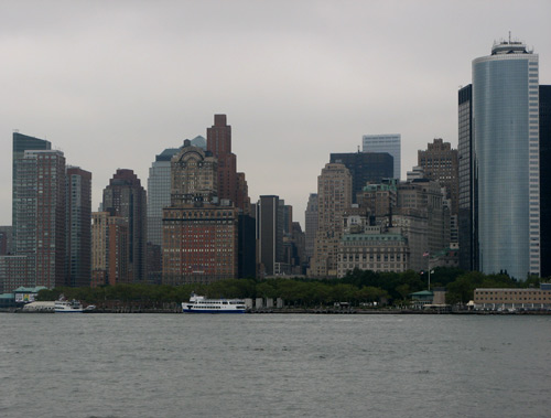
Governors Island lies just a seven minute ferry ride from the southern tip of Manhattan, at the confluence of the Hudson and East Rivers. After taking over “Noten Eylandt” (and “New Amsterdam”) from the Dutch in 1664, the British New York Assembly renamed Noten “The Governor’s Island” in 1698 and earmarked the land for “the benefit and accommodation of His Majestie’s Royal Governors for the time being.” Eventually both the “The” and the apostrophe were lost, leaving the current name as it stands today.
Its strategic location suited ideally for the command headquarters and military post of the United States Army from 1794 until 1966. From 1966 until their move to Fort Wadsworth in 1996, the island was the United States Coast Guard’s largest and most complex installation. In 2003, Governors Island was sold to New York City for the bargain price of $1.00 and transferred to two parties: 22 acres, designated as the Governors Island National Monument, to the Secretary of the Interior, and managed by the National Park Service; and 150 acres to the Governors Island Preservation and Education Corporation (GIPEC), a corporation formed jointly by the State and City of New York.
Currently, Governors Island is open to the public on a seasonal basis. This summer, public access continues through this Saturday, September 2, 2006. Since it was the last week to take advantage of the free tour and ferry ride out to the Island, I took the day off on Tuesday to explore in the morning, before returning home to take care of more mundane apartment matters.
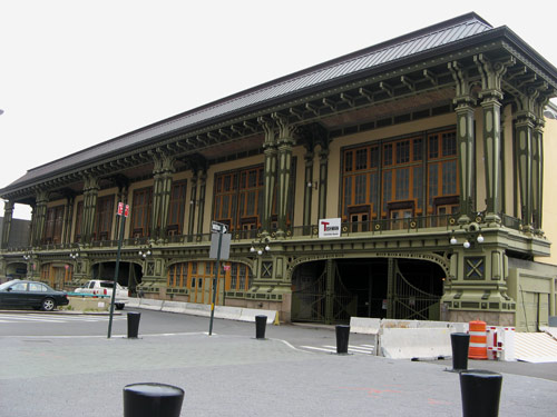
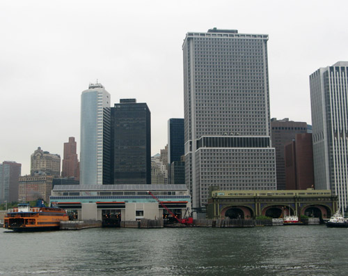
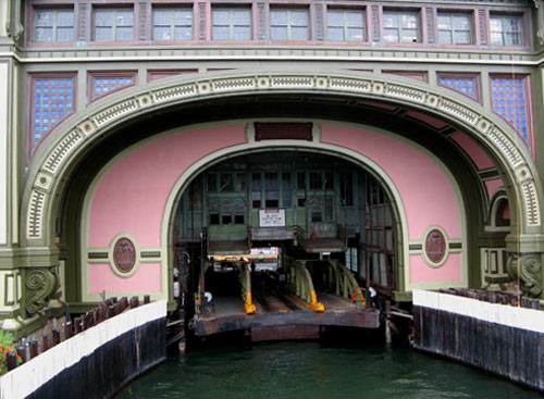
Ferries to Governors Island depart from Slip 7 of the Battery Maritime Building terminal , northeast of the Staten Island Ferry terminal. At one time, this now-crumbling landmark building served as a twin to the original Staten Island Ferry Terminal.
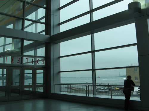
Tuesdays through Thursdays just 40 people are permitted on the Island at a time for a guided tour. B and I arrived by 9:30AM with plenty of time to spare — affording me the chance to check out the new Whitehall terminal again.
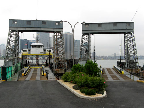
We pulled into Soissons Dock at Governors Island’s northern edge aboard the Coursen, a 1955 vessel certified to accommodate 493 passengers. The dock commemorates “the heroic participation of the 16th U.S. Infantry Regiment from Governors Island in the victorious attack against German forces near Soissons, France, July 18, 1918.”
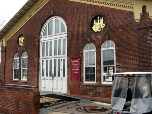
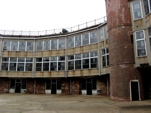
Our group of about 15 was met at the Ferry Waiting Room/Visitors Center by two Parks Department guides – both named Meg[h]an, and one of whom was actually raised on the Island, back when it served as Coast Guard housing. The building across was once the island’s Post Office, and now houses a gift shop and a security station – the first of many repurposed structures on the island we would see over the next hour and a half.
Our tour was limited to the historic district, with the military history. The GIPEC-owned majority of the island, is (from what we were told) far less picturesque, comprised of corporate park, modern apartment complexes, and other supporting features. A prominent white tower sits at the island’s northern end: the air vent to the Brooklyn-Battery Tunnel, which runs beneath Governors Island. For two centuries, the island was run as a small, self-sustaining town for Army, and later Coast Guard, personnel, government employees and their families. There was the aforementioned post office (with a Manhattan zip code), a hospital, elementary school P.S. 26 (most high schoolers had a two-ferry commute to Curtis High School in Staten Island), two churches and a synagogue, a golf course and a Burger King – the only one in the country to serve both pizza and beer (to service the adjacent bowling alley).
Many of these structures have since fallen into disrepair, so we on the tour were only allowed the view from the street for safety reasons.
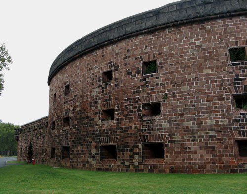
The two most prominent military fortifications on the island are Fort Jay and Castle Williams, which were erected between 1796 and 1811 in preparation for the War of 1812. Both structures sit within the Landmark District and are surrounded by unparalleled views of New York Harbor.
With walls forty feet high and eight feet thick, this round sandstone bastion was set up to accommodate four tiers of cannons, when it was completed in 1811. Castle Williams and its twin fort, Castle Clinton in The Battery, were built to guard the waterway between Governors Island and New York City. The British never attempted to breach the harbor, though, and the growing sophistication and reach of firepower after the War of 1812 rendered these forts obsolete before they ever fired a single blast. A technical point: because the structures are fortified entirely of stone, they are named “castles,” and not “forts.”
Once inside the Castle, its former life as a jail became apparent. From the Civil War through 1966, Castle Williams held as many as 1,000 prisoners at a time. At its most cramped, the unsanitary conditions led to many deaths; later, when conditions improved, it was considered a resort-type minimal security prison for AWOL Army soldiers. Several prisoners are rumored to have escaped from here and successfully swam to Brooklyn.
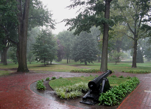
As we left the fort, the rain started coming down hard, limiting the photo opportunities. We passed the elegant brick houses of “Colonels’ Row,” which were built after the Civil War to entice men to join the service. At the time the homes were built, they sat facing the waterfront. By 1901, however, landfill from the excavation of the Lexington Avenue subway line expanded the Island to over twice its original size, pushing the waterfront out of view.
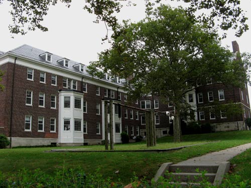
Nolan Park, set in idyllic woods, was the area reserved for the Army and Coast Guard highest officers. The houses in this area are clearly the grandest – mostly brick with tall white-columned entryways, free of the yellow-painted wood siding which marks the lower-ranked officers housing.
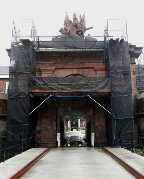
We ended our soggy tour at Fort Jay — named for New York Governor and U.S. Supreme Court Justice John Jay — which was built on the highest point of Governors Island. A dry moat, intended to blend into the surrounding land, runs around the perimeter of the 5-pointed-star-shaped fort (currently under scaffolding.)
The terms of the Governors Island deed transfer protect acres of park land and prohibit the construction of permanent housing, effectively preserving the island for public use by eliminating its value for real estate developers. Other restrictions forbid its use for gaming venues and heavy industry. The Governors Island Alliance has created a set of illustrated guidelines for the parks and public spaces on the 172 acre island. Future plans under consideration for the island include proposals for a waterfront esplanade, hotel, amphitheater, museum, athletic facilities and a new City University of New York campus.
Back in Manhattan…
Search
Popular Tags
Categories
Archive
- July 2010
- July 2009
- January 2009
- November 2008
- September 2008
- August 2008
- July 2008
- June 2008
- May 2008
- April 2008
- March 2008
- February 2008
- January 2008
- December 2007
- November 2007
- October 2007
- September 2007
- August 2007
- July 2007
- June 2007
- May 2007
- April 2007
- March 2007
- February 2007
- January 2007
- December 2006
- November 2006
- October 2006
- September 2006
- August 2006
- July 2006
- June 2006