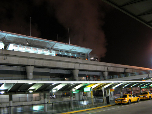
Category: Travel
Get your kicks
Well if you ever plan to motor west
Just take my way, that’s the highway that’s the best
The famed U.S. Route 66, a.k.a. The Main Street of America, a.k.a The Mother Road, once ran between Chicago and Los Angeles, but was replaced largely by the more efficient Interstate Highway System during the 1960s and 70s, after it was decided that the route was no longer relevant. US 66 was officially decommissioned on June 27, 1985. In its decades of existence, the 2300-mile stretch of road became the subject of countless songs, films, books and legends. During the Dust Bowl of the 1930s, more than 200,000 people migrated west to California along the route, supporting the economies of the communities through which the road passed, and symbolizing the highway as the “road to opportunity.” Today, there are few traces remaining; large cross-country sections were absorbed into interstates and other stretches fell into disuse. Route 66 is still the main street of many towns, and several segments of the original road survive, and have been designated National Scenic Byway, now known as Historic Route 66.
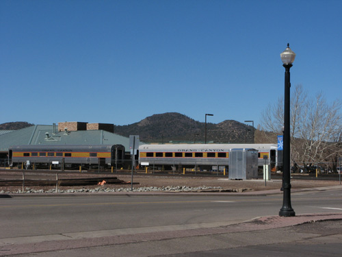
In its heyday, Williams, Arizona was a Route 66 town; nowadays, it is one of those at the heart of the revival. The town was founded in 1876, and fifteen years later, the Santa Fe Railroad lay down 50 miles of track leading from the town to the Grand Canyon National Park, insuring Williams’ claim as Gateway to the Grand Canyon.
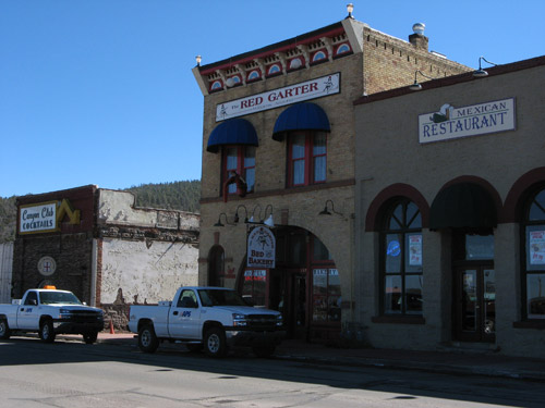
Downtown, souvenir shops offer every imaginable piece of Route 66 memorabilia: kitschy signs, coffee mugs, jewelry, shotglasses, and t-shirts. Vintage storefronts, cafes, galleries and streetlamps evoke some of the old nostalgia — most of which we were able to take in about half an hour.
On to Flagstaff — another stop on the historic route, which we found somewhat less scenic. As we had been warned by the Grand Canyon guides during our check-out, Hwy. 89A to Sedona was closed that day due to area rock and mudslides. Roadblocks at (ironically-named) Slide Rock State Park prevented private vehicles from passing through, so we ended up bypassing the blocked-off area on the interstate, and doubling back on a different route to spend a few hours among the red rocks and vortices.
We lunched at the low-key Wildflower Bread Company, which CS and I discovered on our trip here last year. Fresh-baked breads, tasty salads and sandwiches, and unobstructed views of the colored mountains.
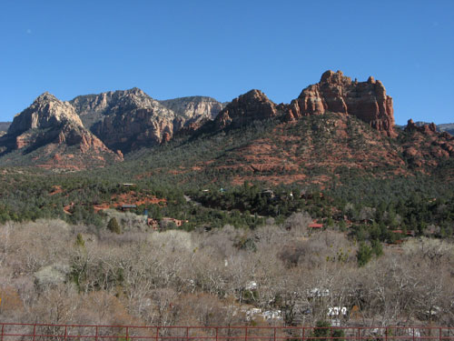
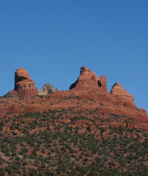
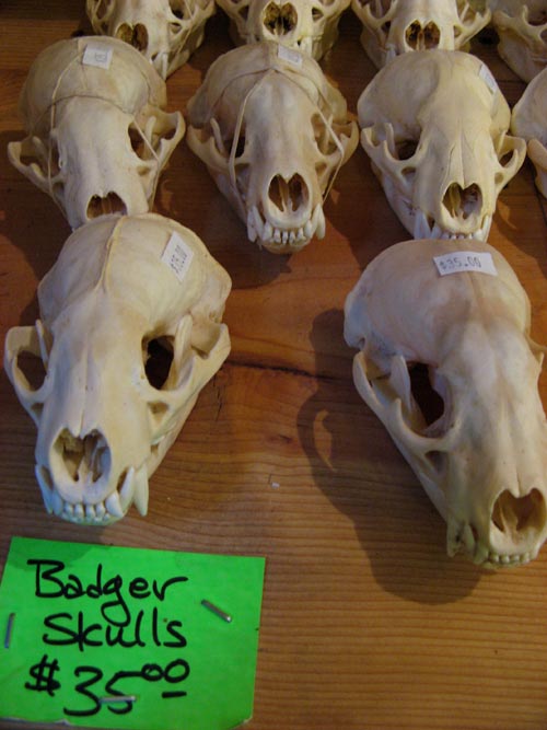
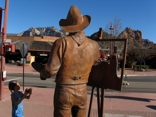
Back at the car, J and I tossed aside our heavy coats — warm sunshine at last! — and spent the rest of the day exploring the picturesque town. We must have popped into a dozen different shops and assorted “trading posts,” picking up strands of polished stones and other small souvenirs along the way… but no animal skulls.
Last look: Grand Canyon
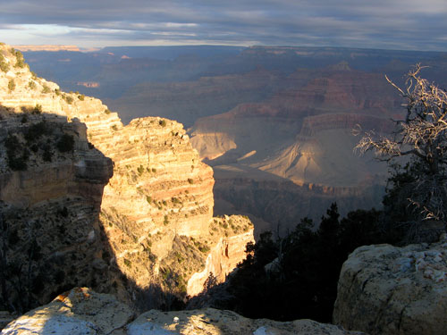
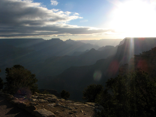
Our final day started well before dawn, as we dragged ourselves achily from our toasty beds to catch the sun’s rise over the Canyon. The Park sponsors a “Surnrise” bus tour, but J and I decided to explore for ourselves.
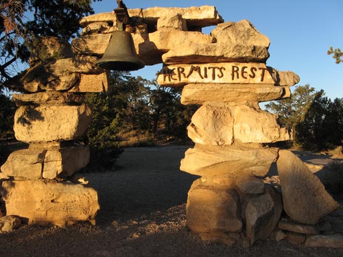
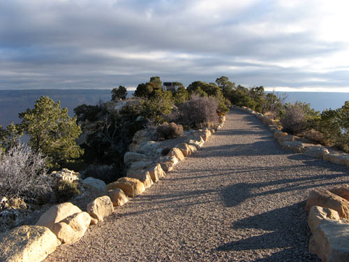
We bundled up with our warmers — thanks SYB! — and set out onto Hermit Road, which leads 8 miles west from Grand Canyon Village to Hermit’s Rest. From March through November, the road is closed off to private vehicles, but in February, we had the rare opportunity to make our own way there without the shuttle bus. Mile for mile, this stretch of road has the greatest concentration of breathtaking viewpoints in the park — each more remote and spectacular than the last. Along the way, there are eight overlooks: Trailview, Maricopa Point, Powell Point, Hopi Point, Mohave Point, The Abyss, Pima Point, and Hermit’s Rest. The official tour stopped as far west as Hopi, so beyond that point, we had the views practically to ourselves.
Hermit’s Rest is the westernmost stop on the South Rim and lies at the end of Hermit Road. It was constructed originally as a rest stop along the stage line to El Tovar. Mary Elizabeth Jane Colter designed this National Historic Landmark structure in 1914 to blend with its natural setting — a stone building set just a few feet from the rim edge, and tucked into a small man-made earthen mound.
The building now houses a snack bar and gift shop — both shuttered for the season. In fact, save for a couple of Arizona gray squirrels, we were alone.
At Powell Point, the site of a memorial to Civil War veteran John Wesley Powell, who, in 1869 with a party of nine men, became the first person to navigate the Colorado River through the Grand Canyon.
After our morning trek, we enjoyed a leisurely breakfast — J’s long-anticipated French toast — at the Bright Angel Lodge. Back at the Maswik, we packed up our things, and hit the road for the scenic drive back to Phoenix. Until next time, Grand Canyon!
| S | M | T | W | T | F | S |
|---|---|---|---|---|---|---|
| 1 | 2 | 3 | 4 | |||
| 5 | 6 | 7 | 8 | 9 | 10 | 11 |
| 12 | 13 | 14 | 15 | 16 | 17 | 18 |
| 19 | 20 | 21 | 22 | 23 | 24 | 25 |
| 26 | 27 | 28 | 29 | 30 | 31 | |
Search
Popular Tags
Categories
Archive
- July 2010
- July 2009
- January 2009
- November 2008
- September 2008
- August 2008
- July 2008
- June 2008
- May 2008
- April 2008
- March 2008
- February 2008
- January 2008
- December 2007
- November 2007
- October 2007
- September 2007
- August 2007
- July 2007
- June 2007
- May 2007
- April 2007
- March 2007
- February 2007
- January 2007
- December 2006
- November 2006
- October 2006
- September 2006
- August 2006
- July 2006
- June 2006